Video Provides a Window to the Marine Environment
Snagging awesome videos of something on land isn’t hard – even most cell phones can do it – but getting great underwater shots requires skill and expertise. The underwater shots in the video found below didn’t come from a professional photographer. They came from biologists tasked with collecting data from a world we can’t easily access – beneath the surface of Oregon’s nearshore ocean.
One of the most robust sources of scientific fishery survey data comes from the long standing trawl surveys, still conducted today, by NOAA’s National Marine Fisheries Service. While this survey provides valuable information used to evaluate fish populations, it is unable to access shallow, nearshore rocky reefs. As a result, there are still many unknowns about nearshore fish populations and a huge need for more research – which is where video surveys are particularly valuable.
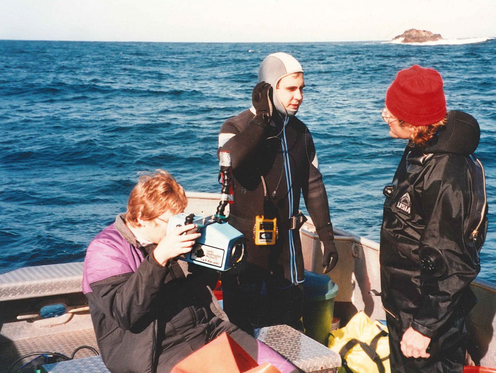
Photo: This archive photo was taken in the early 1990’s off of Port Orford during some of the preliminary video research by ODFW.
“Twenty years ago, we recognized the need to survey nearshore fish and habitats that were being missed by larger, traditional survey techniques. We used to do SCUBA surveys, but these became very challenging below depths of about 60 feet – and most of our rocky reefs occur deeper than that,” said Dave Fox, Oregon Department of Fish and Wildlife Marine Resource Assessment Program Manager. “This pushed us into trying new and different survey techniques, like video surveys.”
Many marine surveys rely on physically collecting fish in order to estimate populations and evaluate overall population status. In contrast, video survey techniques take only pictures, allowing fish to remain in their natural habitat, while still providing researchers with necessary data, such as species counts, length data, and habitat information, to evaluate populations.
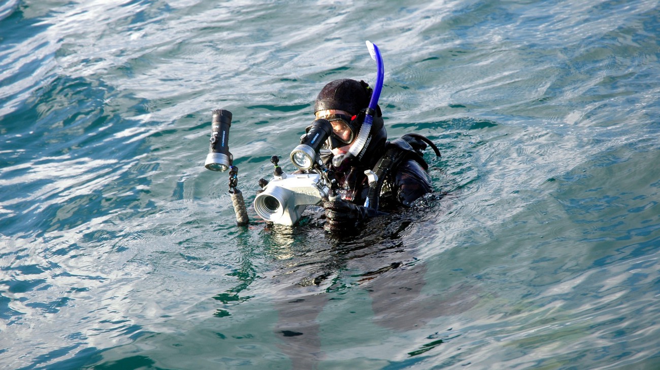
“Video survey techniques have been one of the primary tools we are using in our marine reserves monitoring,” said Dr. Brittany Huntington of the ODFW Marine Reserves Program. “We use video in our lander and remotely operated vehicle (ROV) surveys and are currently testing ways to incorporate video into our SCUBA surveys.”
Another upside of video surveys is that they are not just for fish – scientists at ODFW also gather information about habitats, invertebrate populations and even algal community composition.
So, what happens once the video footage is collected?
Back in the office, two or more biologists will each independently review the video and enter species and habitat data into a database. In a dark, windowless room, ODFW Biologist Steve Kupillas scrutinizes a video screen to identify and count fish, and record data about habitat. Currently, he’s reviewing video taken during the ODFW Habitat Project’s recent ROV survey conducted at Redfish Rocks Marine Reserve this past spring. Literally dozens of fish dart in and out of the shot, making counting seeming like a daunting, if not impossible task. But, Steve doesn’t seem phased.
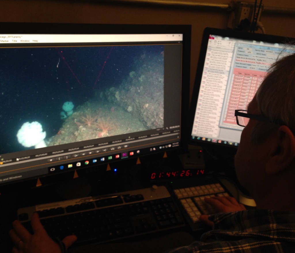
“Collecting data for video review isn’t easy and we have a strict methodology we always follow. Basically, I’ll review the every shot six different times, each time collecting different information such as: water visibility, invertebrate and fish identification and counts, bottom habitat types, and even how far the camera is off the bottom,” said Steve. “This past spring’s ROV survey consisted of 74 transects that are about a half kilometer in length, so I’ll have reviewed just over 20 miles of sea floor habitat by the time I’m done,” said Steve.
Next to Steve, sits a large cabinet containing orderly stacks of dated hard drives containing thousands of hours of video taken over the past two decades. This valuable archive contains a living record of what the ocean bottom looked like during that time period. Researchers can revisit this archive to look for changes over time in abundances, diversity and sizes of different marine life to help answer a multitude of questions related to marine reserves science and nearshore ocean management. For example, in the wake of sea star wasting syndrome, the ROV video archive contains some of the only nearshore information in Oregon about sea star abundance prior to the massive sea star die off of 2014. This density data helps scientists establish a pre-disease baseline from which to understand the impact of that outbreak to Oregon’s sea star population living offshore.
While there is still much to learn about Oregon’s nearshore ocean waters and marine reserves science, video surveys provide a glimpse at the world beneath the ocean’s surface. The ODFW Marine Reserves Program is continuing their underwater video survey work, and over the next few months will be working on testing their new stereo video system.
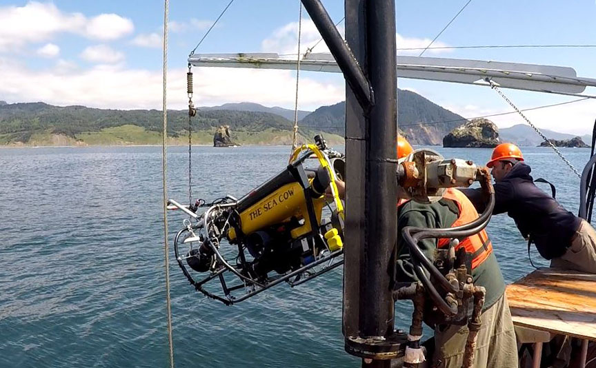
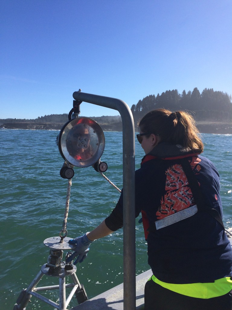
Photo: Launching the Remotely Operated Vehicle (ROV); a camera system that allows researchers to collect underwater data.